Discover the region

Municipal campsite Les Ruisses is ideally located in the heart of the Verdon Regional Natural Park, 200m from the Lac de Sainte Croix. From here you can discover the Provence region and the magnificent Gorges du Verdon.

For complete tourist information about this region, you can also visit the following websites:

Gorges du Verdon

A unique natural site in Europe

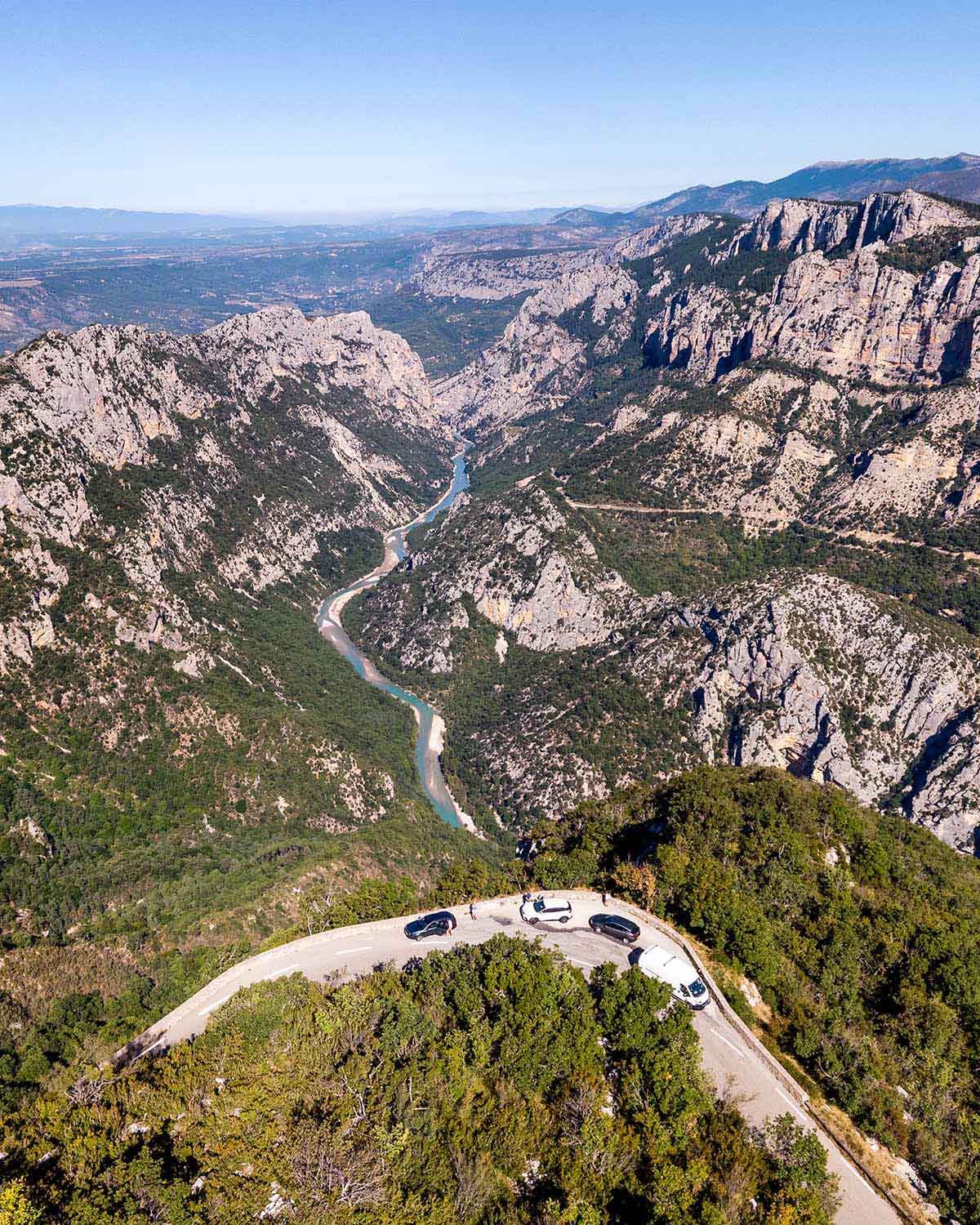
This spectacular canyon results from the limestone erosion of the plateaus of Haute Provence by the Verdon river that springs near the col d’Allos, in the massif of the Trois Évêchés. The 50 km long canyons stretch from Castellane to the lake of Sainte-Croix, and reach 700 metres in depth in places.

A multi-facetted sports ground

The canyons present many sports opportunities. From hiking paths of all levels that follow the river banks to nautical or air sports, everyone will discover the pleasure of surpassing themselves here. When looking at the sky, you could see a griffon vulture or a lappet-faced vulture soar above your head… You can also drive through the gorges by car, by following the Route des Crêtes or the Corniche Sublime road. They are built in such a way that they enable frequent stops at the scenic viewpoints which provide an exceptional view.

  tip : Brochures containing the trails are for sale in most souvenir shops.
View of the Gorges and Col d'illoire from the Corniche Sublime
View of the Gorges and Col d’illoire from the Corniche Sublime

Lac de Sainte-Croix

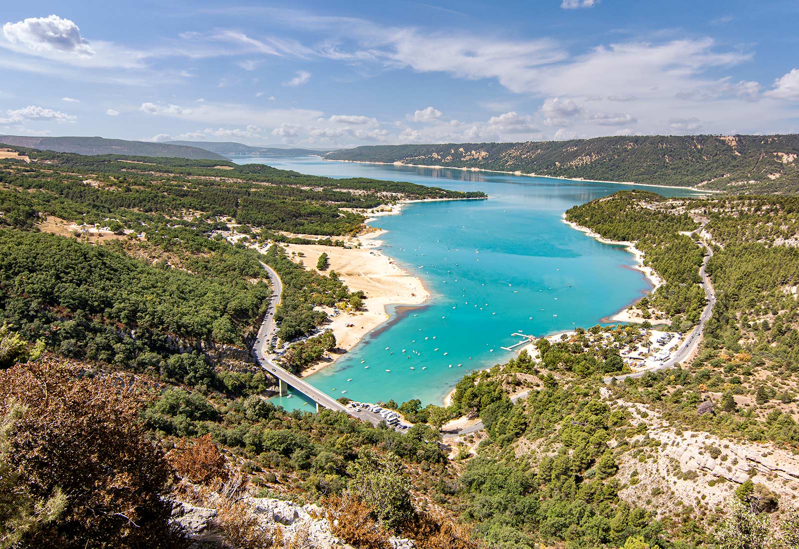
The Lake of Sainte-Croix (French: lac de Sainte-Croix) is a man-made lake, impoundment in 1973, following the construction of the Sainte-Croix dam, on the course of the Verdon. It is located between the departments of Var and Alpes-de-Haute-Provence at the foot of the Verdon Gorges, the Plan of Canjuers and the Plateau of Valensole, the Mecca of growing lavender.

The largest lake of the Verdon covers an area of ​​2200 ha (10 km long and 3 km wide), bounded on the south by the hydroelectric dam of Sainte Croix and north by the bridge Galetas, where the Verdon Gorges feed into the lake. The dam (thin arch type), built at the entrance of the gorge Baudinard, holds 760 million cubic meters of water over a year and produces over 150 million KW / H. It supplies electricity and many of the towns in its vicinity. The lake, beyond its usefulness as a water reservoir for the Provence or electricity generation, has become a popular tourist attraction.

In a magnificent landscape, framed by hills of the Haut Var and Valensole, Lake Sainte Croix offers turquoise waters to the pleasures of travelers. Here you can swim, sail there, electric boat, water cycle, moving up the gorges of Verdon. Only electric boats are licensed to operate on the lake, which guarantees a perfect water quality.

The other villages around the lake are :

  • Sainte-Croix-du-Verdon
  • Bauduen
  • Les Salles-sur-Verdon (new village, the former was drowned by the lake)
Lac de Sainte-Croix and the Galetas bridge, 4 km from our campsite

History

The project of flooding the Salles valley by the creation of a lake on the Verdon river dates back to Georges Clémenceau, in 1908. But it was only implemented by Électricité De France in 1968. Initially the lake was supposed to engulf the villages of Salles sur Verdon, Bauduen and to make Sainte- Croix du Verdon inhabitable. The artificial lake was finally created in 1973, following the construction of the Sainte-Croix dam. The villages of Sainte-Croix and Bauduen were ultimately saved and Les Salles rebuilt sheltered from the water.

The first flooding by the dam took place in August 1973 and the final flooding on November 15, 1973.

  Tip : 4 km from the campsite, at the Galetas bridge, you can rent pedal boats, canoes or electric boats, to discover the Gorges du Verdon by water!
Panoramic view of the Valensole plateau and its many lavender fields

Plateau de Valensole

Erected at 590 m altitude, the village of Valensole has given its name to the whole plateau.

Nicknamed “the region’s granary”, the 800 km2 plateau is mainly dedicated to the cultivation of lavender and grain. It changes in look with the seasons; the snowy peaks and the blooming almond trees of March are replaced in July with the changing purple of lavender and the golden wheat. In November, the ochre of the furrowed land contrasts with the pure blue winter skies.

Lavender

Lavender, just like its aromatic cousins savory, thyme and rosemary, belongs to the mint family (labiatae). They are a bee favourite (melliferous plants) as the delicious honey they produce demonstrates. It comes in different varieties such as Lavandula angustifolia (true lavender) providing better quality essential oil and Lavandula intermedia, or lavandin, the most commonly grown for its productivity.

Uses of Lavender

avender is used in the manufacture of soap, bees turn it into honey; it is also distilled for its scent and its therapeutic properties.

  More information : visit the website of valensole.fr
  Tip : Take your camera and visit the lavender fields to take the most beautiful pictures there!

Sillans-la-Cascade

It’s summer, it’s hot, and you want something other than the beach? Take a trip to the village of Sillans-la-Cascade! Put on your sneakers, take some water, and let’s go!

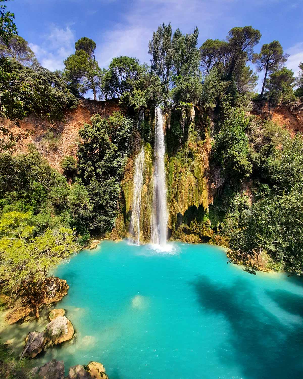
A Provençal nugget protected by its fortified walls and its defensive towers, Sillans-la-Cascade is home to squares, art galleries and gourmet breaks. Nestled in the heart of the forest, the superb waterfall in the colors of the lagoon adds to the magic of the place and perpetuates the image of the village.

It is by crossing Sillans-la-Cascade that you realize the perched character of this charming village. From the road that borders it, you can see, buried in the greenery, the surrounding walls, the towers and the defensive apparatus of the medieval castle.

The superb waterfall flowing below gives this village magic and freshness.

Culture and discovery

The waterfall, the castle, the Saint Laurent Chapel, the Saint-Etienne Church.

In the small village, you can park in the town hall car park, and follow the signs indicating the waterfall, via hiking trails.

At the end of the path, you can savor the turquoise waters, in the shade of the vegetation, bordered by hundred-year-old plane trees: these are the waters of the Bresque, magnified by those of the beautiful spring of the castle of Bresc and the valley of the ‘Ourk.

  More information : visit the website of tourisme-dracenie.com
Sillans-la-Cascade is one of the 23 villages of the Dracenie Provence Verdon

  Tip : Do you have some time left? visit the beautiful village of Cotignac at 8 km more.
View from the balcony on the waterfall with its turquoise waters

Villecroze-les-Grottes

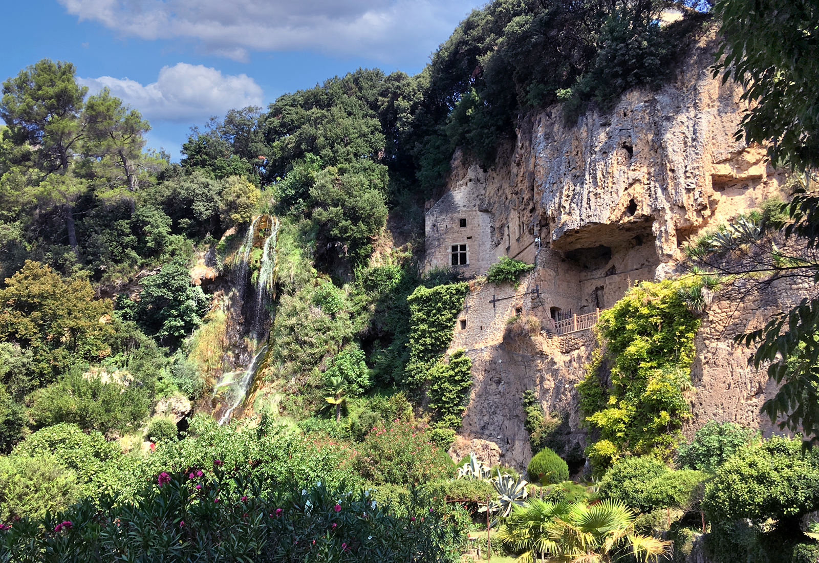
If you are not claustrophobic and have a taste for culture, the Grottes de Villecroze are definitely not to be missed. The caves of Villecoze are full of curiosities. There are guided tours on different days. On these tours, you’ll be led through the caves by a guide so you won’t have to walk around on your own.

The Grottes of Villecroze and the waterfall on the left

History

Formed 700,000 years ago at the end of the last local ice age, the caves are the result of a slow calcification of plants and mosses by a huge waterfall, rich in limestone, which covered the whole of the current cliff .

The rock thus formed, tuff, therefore results from the fossilization of these plants.

The caves as well as a large part of the fields around the village belonged to the Benedictine monks of the Saint-Victor de Marseille abbey. They had a priory then installed near the Saint-Victor chapel (adjoining the current cemetery) and used the caves, still in their natural state, as places of refuge in the event of raids by the Saracens in the 10th century.

They then exchanged the caves with the lord of the valley Nicolas d’Albertas. In 1566, he undertook work to fortify the site and make use of its impregnable position. However, there was never a siege and no one ever lived permanently in the caves.

In 1633, they were ceded to the municipality and remain its property. They were classified in 1924 as Natural Sites and Monuments of an artistic nature because they combine two criteria: history and geology. They are part of the classified natural sites of France.

  More information : visit the website of www.villecroze-tourisme.com Buy tickets at www.grottes-villecroze.fr
  Tip : Do you have time left? visit the village of Tourtour (a site classified as one of the Most Beautiful Villages in France) 6.5 km away.
error: Content is protected !!